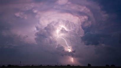
Dark clouds were gathering over the nearby mountain peaks as a brisk wind whisked away the beads of sweat clustered on our foreheads. In the distance, a faint rumble could be detected. Without a subsequent flash of lightning, we could only presume it was thunder. An impending mid-afternoon Rocky Mountain rainstorm appeared to be on the horizon as Ira and I tried to figure out our location.
We were trekking through a challenging Summit County, Colorado trail cluttered with fallen mature tree trunks and rock debris from an avalanche. Until we made it through these hindrances, we weren't always certain if we'd deviated from our intended path. At times, the forest swallowed up the tell-tale marks of a well-established mountain trail. We were forced to rely on our intuition to determine whether we were on track.
Suddenly, we found ourselves engulfed by nature. A quick look at our AllTrails map showed that we had deviated off course. According to the map, the trail was somewhere uphill from where we were standing. Would it be possible to climb through the dense forest to locate the trail? Since we had poor cell coverage, the cursor on the map fluctuated. Could we rely on this app after we lost our signal?
Ira traverses fallen trees in Summit County, Colorado
Ira led the way as we trudged uphill through a potpourri of healthy vegetation, large boulders, and fallen trees. Our bodies were being assaulted by sharp twigs and branches, and it wasn’t easy to remain balanced on unpredictable terrain. My patience was diminishing as fear started to engulf me. Our unsuccessful attempt to rejoin the trail was exacerbated by the distinct sound of thunder and our awareness that we were running low on water. With limited cell reception, I dialed 911. We needed assistance. It was imperative that we find our way off the mountain before the rainstorm arrived.
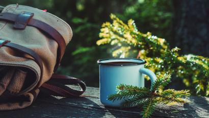
We had left our mountain home at 7:00 AM so we could park in one of the handful of designated spots for the Willow Creek Falls via South Willow Creek Trail in the White River National Forest and the Eagles Nest Wilderness Area. Parking at the Willowbrook Trailhead in Silverthorne, Colorado location was limited to just a few spots and the overflow parking lot was a mile away. Our intention was to take the this out-and-back moderate trail to the popular waterfall. We estimated that our seven-mile round trip journey would take about four hours. A few online sites had mentioned a time allotment of three hours. We knew from past experience to allow additional time for taking photos and simply enjoying our surroundings. We planned to be back home before the daily afternoon storm. Our daypack included rain gear and water for our morning adventure.
In retrospect, we can't explain how we found ourselves on the North Willow Creek Trail instead of the South Willowbrook Trail. We both read the trail signs at each intersection but apparently went the wrong way. Since the signage appeared clear and we were having a wonderful time enjoying the wildflowers and the panoramic views, I didn’t open up my AllTrails App to confirm our location until we'd hiked for more than an hour.
Wildflowers on the North Willow Creek Trail
As we discussed our error at the end of the North Willow Creek Trail, a hiker approached us. He offered three suggestions. The first option was to continue on the Gore Range Trail to Willow Lake. But he warned that this trail was longer and steeper than our original plan. If we were still intent on seeing the waterfall, he suggested crossing the nearby creek and going in the other direction on the Gore Range Trail to the South Willow Creek Trail. A third option was to backtrack and to locate the South Willow Creek Trail. Whichever route we chose would increase our hiking time considerably.
Creek crossing on Gore Range Trail, Summit County, Colorado
With no clouds in sight, we opted to cross the rushing creek. The solitude and majesty of the trail encouraged us to trek further. The deep green forest canopy periodically opened up to meadows filled with wildflowers. From these vantage points, we took pictures of the nearby mountain ranges as well as Lake Dillon and the adjacent towns. Energized by our surroundings, we took time to appreciate everything we encountered as other hikers hastily passed us.
Blue skies above the Gore Range Trail, Summit County, Colorado
Countless cancer and longevity studies have illustrated the positive effect of enjoying natural settings. We were content to linger when we heard water rushing through creek beds and birds chirping nearby and to walk briskly in meadows where we felt the sun’s intense rays. Large rock formations provided a clue that we were approaching the waterfall. The cascading multi-tiered waterfall was a lovely place, well worth the effort.
Willow Creek Falls, Summit County, Colorado
After leaving the falls, we remembered the additional advice provided by the fellow hiker. He told us that we would add several miles if we retraced our steps. Instead, he suggested that we take the first trail that branched to the right after we left the falls. Without hesitation, we followed his recommendation. After all, he had provided accurate information to reach the waterfall.
Steep rock and dense forest near Willow Creek Falls
Most of the other hikers headed in the other direction. I assumed it was because there was more available parking at the other trailheads. I doublechecked the app and it showed we were headed in the right direction. However, I had forgotten that my phone had previously downloaded two different routes to the waterfall. Somehow, the one leading to the Buffalo Mountain Trailhead was the one on my phone’s screen, not the map we had followed earlier.
We reached a fertile spot where multiple creeks converged. Finding the best places to cross this marshy and muddy area was a trial-and-error exercise. After accomplishing this task, we continued to cope with an abundance of large tree trunks blocking our way. We were surprised by the number of tricky obstacles.
Creek crossing choked with downed trees
A few more clouds started to form. I realized that we needed to accelerate our meandering pace. After hours of walking non-stop, my body was not cooperating. Ira, on the other hand, remained full of energy. His glioblastoma diagnosis was not standing in his way. He helped me through the rock scrambles and showed me the best way to climb over the massive tree trunks. His patience allowed for frequent rest breaks so my heart rate could lower after we trekked up steep inclines.
Frequently, we had a couple of options. At one point, we could either veer to the right and take a steep, root-infested path or continue going straight through a flume. The AllTrails app indicated we were off track when we went uphill so we headed back to the more even terrain. After going a short distance, we realized that this path was a bad choice, and the AllTrails app confirmed this fact.
Our water supply was running low. My parched throat along with my elevated heart rate and Ira’s crusted lips were the beginning signs of dehydration. When we were younger, I would have been less concerned if we became dehydrated while hiking or were temporarily lost. But as grandparents our bodies are less resilient. I was also keenly aware of the fact that dehydration can bring on seizures, a common brain cancer side effect.
When making the decision to call 911, Ira’s safety was my prime concern. I would never forgive myself if a mountain hike created a health concern for him. The 911 dispatcher was supportive and understood my apprehensions. Since the AllTrails app was showing inconsistent information, I asked for assistance in finding the trail. Even though my cell phone signal was faint, she was able to locate us.
She forwarded our situation to the Summit County Rescue Group (SCRG). This all-volunteer, non-profit organization offers backcountry search and rescue services 24 hours a day, 365 days a year. While we were waiting for the return phone call, we came to the conclusion that forging our own uphill trail was a futile endeavor. We were putting ourselves at greater risk of getting seriously injured. We started to retrace our steps to see if we could find the path leading uphill which we had previously started up.
Due to the very poor cell phone reception, Mark Svenson, a SCRG mission coordinator, had to try more than once before we successfully connected. When I received his call, we had already found the path leading uphill. My earlier fears were starting to dissipate until we reached another area where the trail disappeared. Once again, I reached out to Mark. With the help of the 911 dispatcher, we were given additional assistance. In a text message, I was assured that we were close to the top of Wildernest and that we would be driven back to our car. I was confused, since I knew we had not left our car near a Wildernest trailhead.
On a very steep rock field, we encountered a young man heading down to the falls who was equally frustrated by the trail. Even though he had hiked to the waterfalls a few times before, he said, “I always lose my way on this trail.” With no water left, I asked if he could spare some water. Luckily, he had plenty of water and was willing to share a plastic water bottle.
This generous man let us know that we had a few more steep areas to climb before we reached easier terrain. We slowly proceeded uphill as the sky darkened. When we were almost at the top of the last steep pitch, we were greeted by Charles Pitman, another SCRG mission coordinator, and one his colleagues, Anna DeBattiste, along with a Summit County sheriff officer named Brian Metzger. A bag of trail mix and additional water were welcome relief.
After walking more than eleven miles and being on our feet for more than eight hours, I was noticeably fatigued. Ira’s stamina remained intact. The team insisted on walking with us. My body met the challenge of the last rock scramble with a helping hand, while Ira scurried without any assistance.
As large raindrops began to pelt the dry terrain, we exited through the remains of a forest charred by a forest fire a few years ago. The new growth along with yellow flowers were an eclectic mix. I stopped for a second to take a picture. It had been hours since I had used precious battery life to take any photos.
When we finally reached the trailhead, I now understood why we needed a ride. The man who had offered useful information to reach the waterfall had routed us to a different trailhead and I had used the wrong map to guide us back from the waterfall. Charles let us know that we had ended up on an old mining canal that was no longer maintained and is filled with deadfall. Unfortunately, this abandoned trail is sometimes picked up by GPS apps. After Ira completed the necessary paperwork, Mark drove us to our parked car.
Sandy & Ira with Summit County Rescue Group
Back in our mountain home, we were grateful to be safe. Trekking on mountain trails is exhilarating but can be filled with potential dangers. After decades of hiking all over the world, we have the strength to persevere when challenges arise, as well as the common sense to know when it is necessary to seek help.
On this particular day, we confronted missteps that increased our chances for a disastrous outcome. Going forward, we will definitely pack more water than we anticipate using. We saw first-hand how an app can become unreliable when cell coverage is inadequate. By reaching out for help, I was confident we would be able to look back on this day with a smile on our faces rather than tears in our eyes. We appreciate the Summit County volunteers who came to our aid when we became concerned of the likelihood of becoming stranded on a mountain during a Rocky Mountain afternoon rainstorm.
When Sandy Bornstein isn’t trekking in Colorado or writing, she's traveling with her husband Ira. After living as an international teacher in Bangalore, India, Sandy published an award-winning book, May This Be the Best Year of Your Life, as a resource for people contemplating an expat lifestyle and living outside their comfort zone. Among other things, Sandy writes about family, intergenerational, and active midlife adventures highlighting land and water experiences.