On the west side of Tiger Mountain in the Issaquah Mountains in Washington is a bare plateau known as Poo Poo Point. Don’t let the name fool you.
Named by Harvey Manning, due to sounds that steam whistles would make from logging, this is a very popular destination for hikers, photographers, and paragliders.
Hiking to Poo Poo Point via High School Trail
There are two trails leading to the point - High School Trail and Chirico Trail. Chirico is the shorter of the two, and we intended on hiking this route. However, the parking lot was full at the trail head so we drove to Issaquah High School and took the longer route. The High School Trail is about 8 miles round trip versus the shorter 3.8 mile round trip the majority of people take.
Getting There
The High School Trail is accessible behind Issaquah High School. We visited on a Saturday and the parking lot was full of other day hikers. We didn’t notice any parking permit requirement signs and decided all must be good.
UPDATE: A reader wrote in and provided us with a little more information on parking at the high school. A permit is required to park at the school during the school day. If school is not in session, there are no parking restrictions. Street parking around the high school is also at a minimum right now due to construction of the new middle school.
Walk up the stairs to the tennis courts, and you’ll come to The Rainier Trail. Make a right and walk about 1,000 feet until you see a sign on your left for High School Trail. Your hike starts here!
The Hike
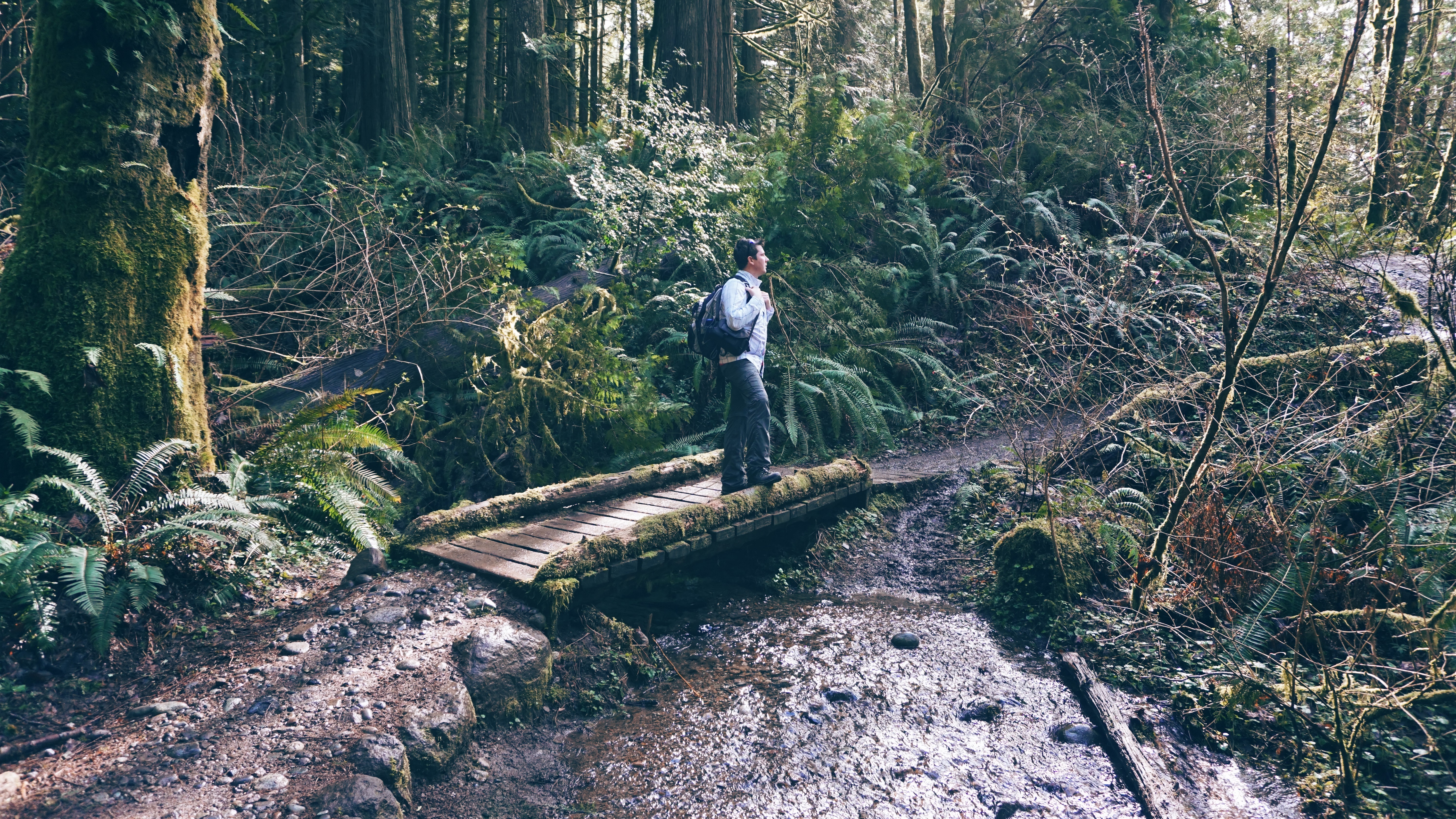
We started the hike by going up right away. And then up and up and up some more. And up even more. We’d estimate that about 75% of the trail on the way to the top consists of a pretty steep incline. This was one of the steepest hikes we’ve done. The trail is a mix of rocks, tree roots, muddy spots and areas spongy with trampled pine needles. We stopped often for water breaks.
After about ½ mile the trail momentarily flattens out. On the left we saw a sign for Adventure Trail. We felt like we were already on a pretty good adventure so we stuck to our plans and proceeded forward.
Continuing on we reached another trail off to the left, Section Line Trail. After this point our steep journey up began again. This time even steeper.
Along the way we crossed under a set of powerlines, over two creeks, and passed by many others out enjoying the day. The trail was well maintained and there was only one tree down on our way up. On the return hike someone with a chainsaw was cutting the downed tree out of the way.
This is a pleasantly quiet trail. The sounds of wind in the trees, twittering of birds and the frequent gurgling of water tumbling over rocks are what surround you. It is one of those great trails for enjoying the peace of nature. Although this trail was really steep, we saw plenty of families with young children and folks with dogs managing quite well.
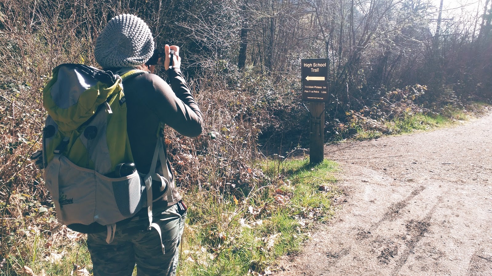
Our next waypoint was a three trail junction. W Tiger Railroad Grade and One View Trail both meet up with High School Trail here. We stayed on course and shortly began to descend in elevation. As we continued going downhill at this point we were wondering if maybe we were supposed to take one of the previous trails. We brought up Google Maps on the phone, and we were still on course.
We reached another sign and a dirt road. The face of the sign was in the opposite direction. Once past it, we looked back and it said Poo Poo Point Trail/Issaquah High School 4.1 miles, pointing in the direction we just came from. Now we were a little concerned. Looking around it’s not apparent that our destination was nearby. Looking at other peaks in view, we still seemed to be quite a way off. However, we stayed on course and traveled down the road.
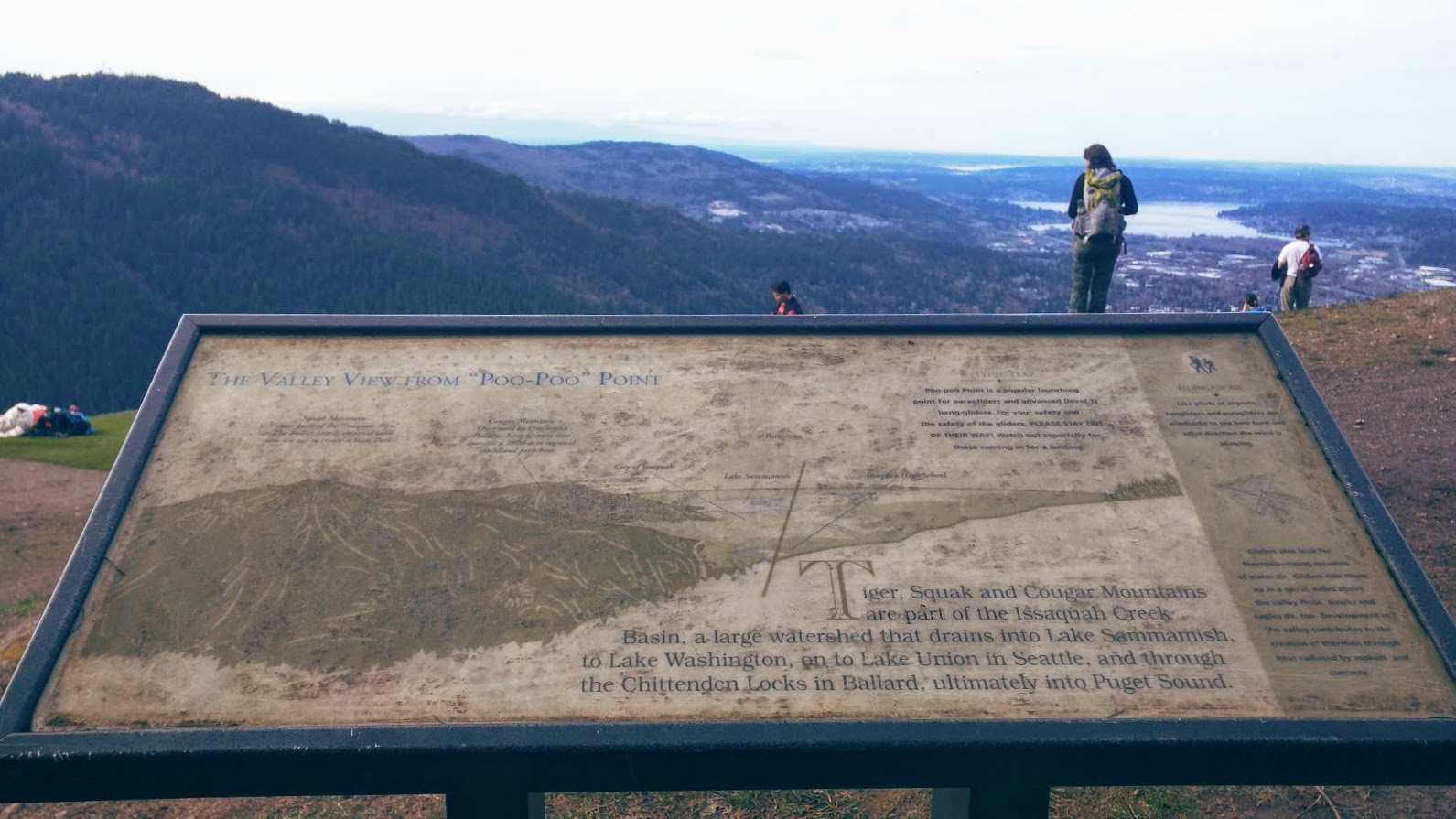
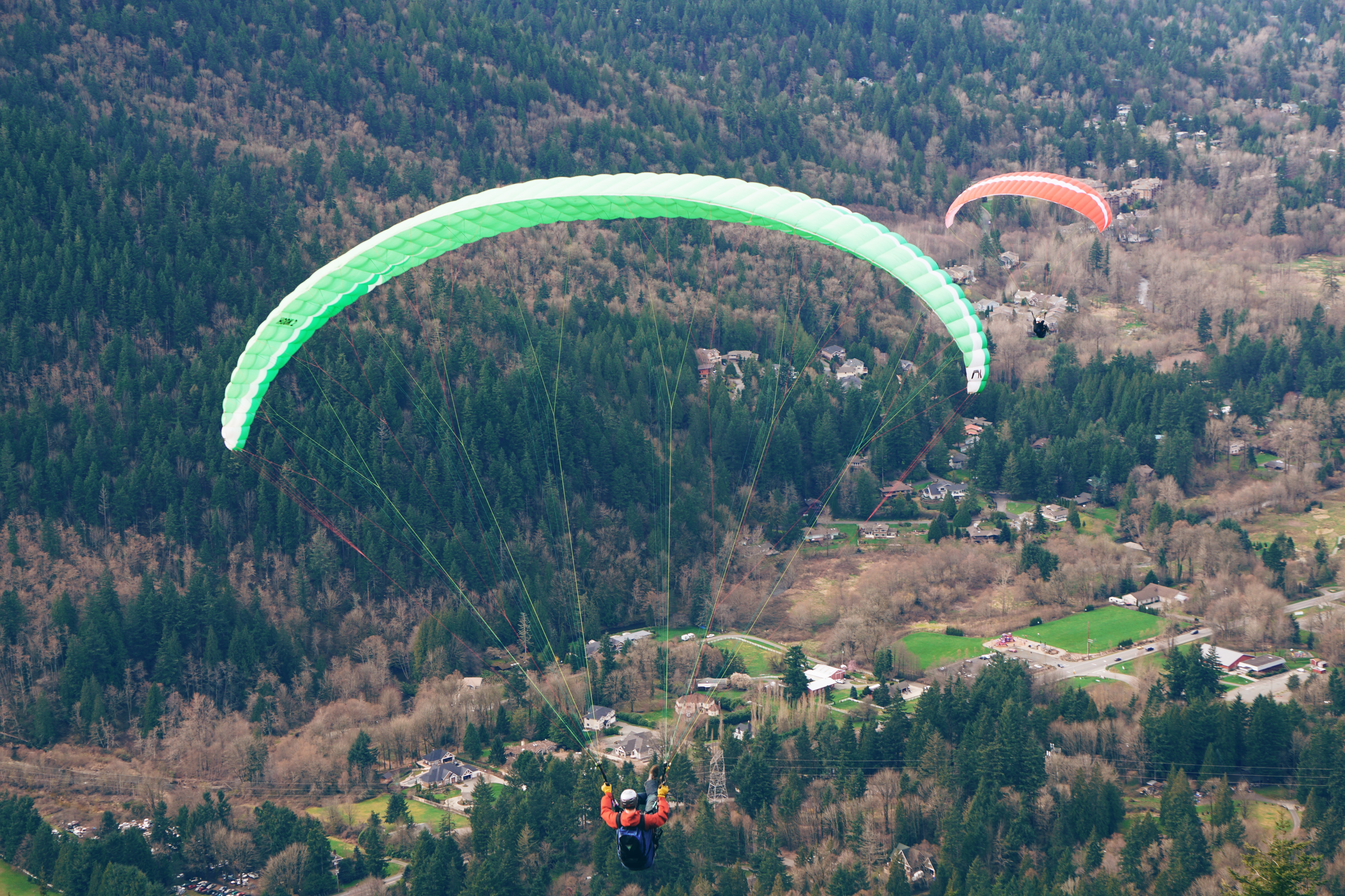
It wasn’t far until we reached a vaulted toilet and a parking lot. Just past these, off to the right was Poo Poo Point. There was probably around 30 people here. Many of them with their phones out and ready to film paragliders. We got here just in time.
The Summit
We took photos, filmed the first of the daredevil paragliders taking off, then sat at a picnic table for lunch. The hike up was quite a bit of work and we were pretty warm the entire time. Now at the top, and now that we stopped moving, we started to get colder. It was windy up here. Time to throw on another layer of women's clothing.
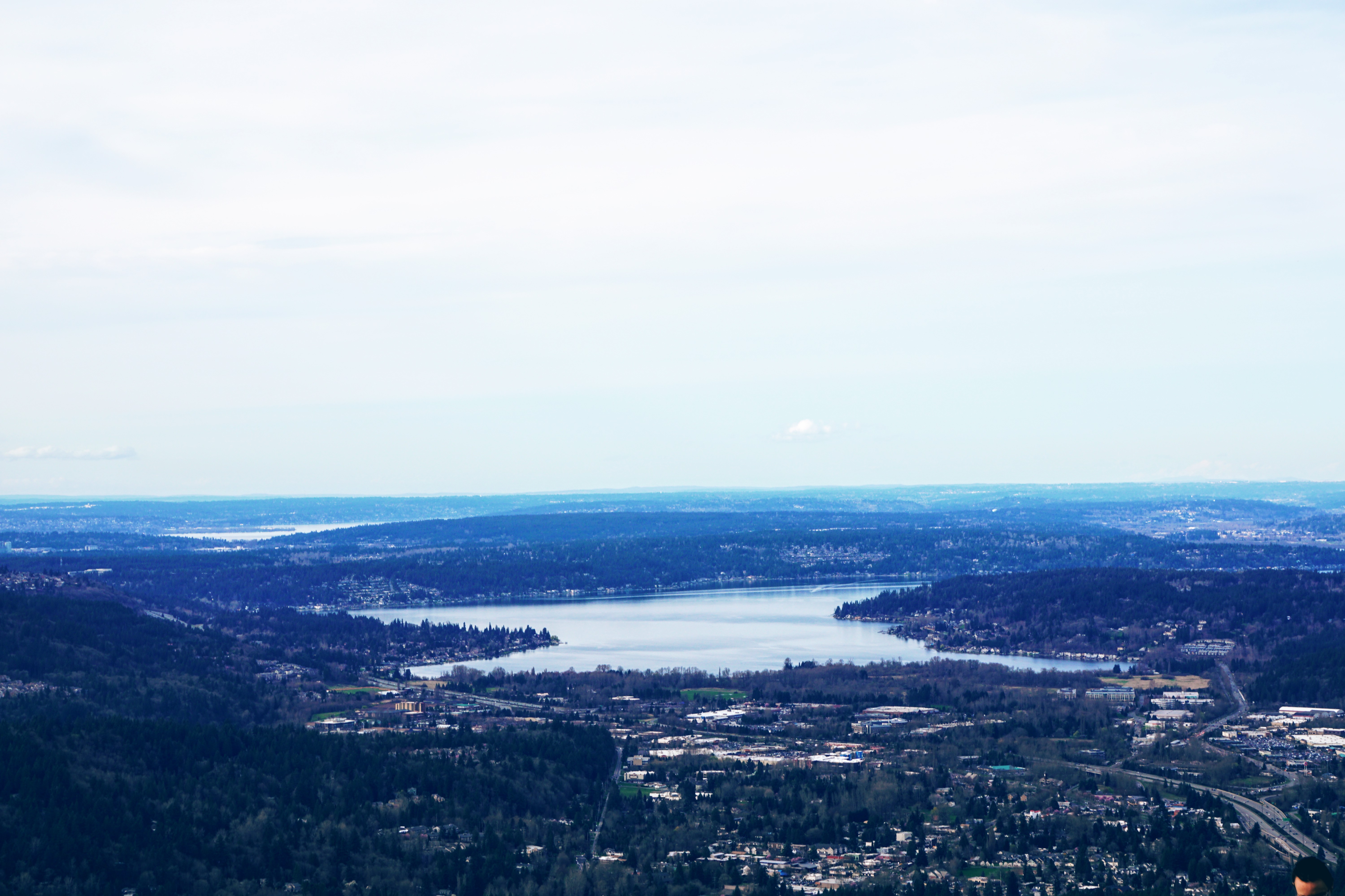
After lunch we walked around the area for better views. The day was mostly clear and we could see a great distance. We were able to spot out Lake Sammamish, Lake Washington, the buildings of Bellevue, and a bit of the Olympic range. We were also able to clearly see our starting point. It looked like a much greater distance away than we just hiked. Knowing that, we knew the hike back wouldn’t be too bad.
We stuck around a bit longer to watch three other paragliders launch off of the AstroTurf field. We also saw a minibus pull up in the parking lot behind us. Out came another group of 5 or so paragliders with all of their gear.
Speaking of the parking lot and the road that leads to it (which isn’t the road we hiked in on at the end of the trail), we actually drove that seven mile distance last year from the Tiger Mountain parking lot, off of State Route 18. After hiking a different trail in the area that day we still wanted to explore. The gates for the roads were open and there were no signs indicating that the roads were off limits to vehicles. So we drove until it lead to Poo Poo Point, which we didn’t know existed at the time. We didn’t stay long, fearing that the gate may be closed by the time we got back. Luckily it wasn’t. We’re still not sure if the road is open to all or only authorized vehicles, like the minibus.
We started our return trip at 3:40 P.M. We jogged about ¼-½ of the distance. It was easy going and we passed by a few others, some heading down, some heading up. Upon reaching the Jeep we were pretty exhausted. We didn’t plan on doing the distance we did, but we were glad we did it.
Conclusion
This is a great hike if you’re pressed for time and aren’t able to drive further from the city. We will go back and try the Chirico Trail next time. The fragrance of damp forest debris and pine fill the air here. Though a heavily trafficked trail, there are plenty of opportunities for solitude and oneness with your surroundings. Find your trail, find your center!